PM to ChuckHIV

Comments
-
Pack your oilskins, and you’re patience.
-
I also heard it might rain.
I dont see the correlation between a river and a football game. -
Three Rivers Stadium was a multi-purpose stadium located in Pittsburgh, Pennsylvania, from 1970 to 2000. It was home to the Pittsburgh Pirates of Major League Baseball (MLB) and the Pittsburgh Steelers of the National Football League (NFL).chuck said:I also heard it might rain.
I dont see the correlation between a river and a football game.
Location
792 W General Robinson St
Pittsburgh, Pennsylvania 15212
Coordinates
40°26′48″N 80°0′46″W
Owner
Pittsburgh
Operator
Pittsburgh Stadium Authority
Capacity
Football: 59,000
Tenants
Pittsburgh Pirates (MLB) (1970–2000)
Pittsburgh Steelers (NFL) (1970–2000)
Duquesne Dukes (1971)[4]
Pittsburgh Maulers (USFL) (1984)
Pittsburgh Panthers (NCAA) (2000)
Pennsylvania Historical Marker
Designated
November 26, 2007[5]
Built as a replacement for Forbes Field, which opened in 1909, the US$55 million ($406.4 million today) multi-purpose facility was designed to maximize efficiency. Ground was broken in April 1968 and an oft behind-schedule construction plan lasted for 29 months.[6] The stadium opened on July 16, 1970, when the Pirates played their first game there. In the 1971 World Series, Three Rivers Stadium hosted the first World Series game played at night. The following year, the stadium was the site of the Immaculate Reception. The final game in the stadium was won by the Steelers on December 16, 2000. Three Rivers Stadium also hosted the Pittsburgh Maulers of the United States Football League and the University of Pittsburgh Panthers football team for a single season each.[7][8]
After its closing, Three Rivers Stadium was imploded in 2001, and the Pittsburgh Pirates and Pittsburgh Steelers moved into newly built stadiums: PNC Park and Heinz Field (now Acrisure Stadium), respectively.
History
Edit
Planning and construction
Edit
A proposal for a new sports stadium in Pittsburgh was first made in 1948; however, plans did not attract much attention until the late 1950s.[9] The Pittsburgh Pirates played their home games at Forbes Field, which opened in 1909,[10] and was the second oldest venue in the National League (Philadelphia's Connie Mack Stadium was oldest, having opened only two months earlier than Forbes). The Pittsburgh Steelers, who had moved from Forbes Field to Pitt Stadium in 1964, were large supporters of the project.[9] For their part, according to longtime Pirates announcer Bob Prince, the Pirates wanted a bigger place to play in order to draw more revenue.[11]
In 1958, the Pirates sold Forbes to the University of Pittsburgh for $2 million ($18.8 million today). The university wanted the land for expanded graduate facilities.[11] As part of the deal, the university leased Forbes back to the Pirates until a replacement could be built.[12] An early design of the stadium included plans to situate the stadium atop a bridge across the Monongahela River. It was to call for a 70,000-seat stadium with hotels, marina, and a 100-lane bowling alley.[13] Plans of the "Stadium over the Monongahela" were eventually not pursued.[14] A design was presented in 1958 which featured an open center field design—through which fans could view Pittsburgh's "Golden Triangle".[15] A site on the city's Northside was approved on August 10, 1958, due to land availability and parking space,[15] the latter of which had been a problem at Forbes Field.[9] The same site had hosted Exposition Park, which the Pirates had left in 1909.[16] The stadium was located in a portion of downtown difficult to access;[11] political debate continued over the North Side Sports Stadium and the project was often behind schedule and over-budget.[15][17] Arguments were made by commissioner (and former Allegheny County Medical Examiner) Dr. William McCelland that the Pirates and Steelers should fund a higher percentage of the $33 million project ($275.6 million today). Due to lack of support, however, the arguments faded.[15][18]
Ground was broken in 1968 on April 25,[15][19][20] and due to the Steelers' suggestions, the design was changed to enclose center field.[15] Construction continued, though it became plagued with problems such as thieves stealing materials from the building site.[15] In April 1969, construction was behind schedule and the target opening of April 1970 was deemed unlikely to be met.[21] That November, Arthur Gratz asked the city for an additional $3 million ($22.2 million today), which was granted.[22] In January 1970, the new target date was set for May 29; however, because of a failure to install the lights on schedule, opening day was delayed once more to July 16.[22] The stadium was named in February 1969 for its location at the confluence of the Allegheny River and Monongahela River, which forms the Ohio River.[23][24] It would sometimes be called The House That Clemente Built after Pirates' right-fielder Roberto Clemente.[25]
Opening Day
Edit
In their first game after the All-Star Break in 1970, the Pirates opened the stadium against the Cincinnati Reds on Thursday, July 16; who won, 3–2.[26][27] The team donned new uniform designs for the first time that day, a similar plan was for new "mini-skirts" for female ushers. However, the ushers' union declined the uniform change for female workers.[28] A parade was held before opening ceremonies. The expansive parking lot, both Pirates and Steelers team offices, the Allegheny Club (VIP Club) and the press boxes and facilities were not opened until weeks later due to extended labor union work stoppages. Instead of allowing cars to park, the team instructed fans to park downtown and walk to the stadium over bridges or take shuttle buses. The opening of Three Rivers marked the first time the Pirates allowed beer to be sold in the stands during a game since the early 1960s.[28]
During batting practice on that day, a stray foul ball hit a woman named Evelyn Jones in the eye while she was walking the stadium's concourse. She sued the Pirates and their subsidiary that managed the stadium, arguing that the Baseball Rule, which usually prevents spectators at baseball games from holding teams liable for foul ball injuries, did not apply because she was away from the seating areas and not watching what was going on on the field. A jury awarded Jones $125,000, but it was reversed on appeal. That decision was in turn reversed by the Pennsylvania Supreme Court, which agreed with her argument about the Baseball Rule and also noted that the opening to the concourse through which the foul had passed was a purely architectural choice that was not necessary to the game of baseball.[29]
Design and alterations
Three Rivers Stadium was similar in design to other stadiums built in the 1960s and 1970s, such as RFK Stadium in Washington, Shea Stadium in New York, Riverfront Stadium in Cincinnati, the Houston Astrodome, Veterans Stadium in Philadelphia, and Busch Memorial Stadium in St. Louis, which were designed as multi-purpose facilities to maximize efficiency.[30][31] Due to their similar design these stadiums were nicknamed "cookie-cutter" or "concrete doughnut" ballparks.[11] The sight lines were more favorable to football; almost 70% of the seats in the baseball configuration were in fair territory.[11] It originally seated 50,611 for baseball,[11] but several expansions over the years brought it to 58,729.[32] In 1993, the Pirates placed tarps on most of the upper deck to create a better baseball atmosphere, reducing capacity to 47,687.[11][33][34]
Three Rivers was the first multi-purpose stadium and the first in either the NFL or MLB to feature 3M's Tartan Turf (then a competitor to the dominant AstroTurf), which was installed for opening day.[35][36] It had a dirt skin infield on the basepaths for baseball through 1972,[26] until converted to "sliding pits" at the bases for 1973.[37] Renovations for the start of the 1983 baseball season included replacing the Tartan Turf with AstroTurf, the center field Stewart-Warner scoreboard being removed and replaced with new seating—while a new Diamond Vision scoreboard with a White Way messageboard was installed at the top of the center field upper deck—and the outfield fence being painted blue from the previous aqua.[38][39] The field originally used "Gamesaver vacuum vehicles" to dry the surface, though they were later replaced by an underground drainage system.[36]
Due to Three Rivers Stadium's multi-purpose design, bands including Alice Cooper, Led Zeppelin, Pink Floyd, The Rolling Stones, and The Who hosted concerts at the venue.[41][42] On August 11, 1985,[43] Bruce Springsteen and the E Street Band hosted the largest concert in Pittsburgh history, when they performed for 65,935 on-lookers.[44] And in 1992, the Pittsburgh Penguins celebrated their second Stanley Cup victory at the Stadium.[42] The stadium hosted various Jehovah's Witnesses conventions, including international conventions in 1973 and 1978, and a centennial conference in 1984. A Billy Graham Crusade took place at Three Rivers in June, 1993.[45] The venue also served as the premiere of the 1994 Disney film Angels in the Outfield which, despite being based around the California Angels, paid homage to the original 1951 film, which featured the Pirates in "heavenly" need.[46]
Three Rivers Stadium had a beverage contract with Coca-Cola throughout its history. It was during the Steelers' stay in Three Rivers that the now famous "Mean Joe" Greene Coke commercial aired, leading to a longstanding relationship between the two. When Heinz Field opened, Coca-Cola also assumed the beverage contract for that stadium (the Pirates signed a deal with Pepsi for PNC Park before signing with Coke again in 2014), and also became the primary sponsor for the Steelers' team Hall of Fame, the Coca-Cola Great Hall. After the initial 10-year contract expired, Heinz Field contracted with Pepsi for exclusive pouring rights, breaking a 50-year tradition with the Steelers.
-
Pittsburgh is a cool fucking city. Very underrated.
Doesn't have the FILTH of the west coast cities.
-
So, do we like it dirty or not?PurpleThrobber said:Pittsburgh is a cool fucking city. Very underrated.
Doesn't have the FILTH of the west coast cities. -
PurpleThrobber said:
Pittsburgh is a cool fucking city. Very underrated.
Doesn't have the FILTH of the west coast cities.
-
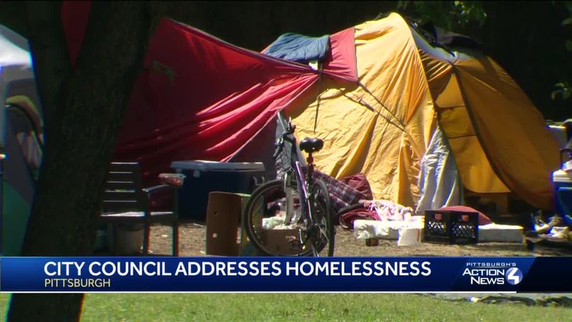
Looks like they addressed it.DerekJohnson said:PurpleThrobber said:Pittsburgh is a cool fucking city. Very underrated.
Doesn't have the FILTH of the west coast cities.
-
@chuck
When we get to within approximately 72 hours before a weather event, powerful high-resolution tools become available, and these can be critical with the complex terrain of our region. Let me tell you what these tools are telling us.
The Super Rainshadow
The atmospheric river has now made landfall on western Washington and rain has spread eastward across the region. As predicted, a profound rainshadow is apparent on the latest radar image, with essentially dry conditions over much of Kitsap County east of the Olympics (see below).
The latest super-high resolutin forecast for precipitation over the next 72 hr (below), shows a distinct rainshadow, with less than .5 inches northeast of the Olympics, while up to ten inches is found over the mountains. And eastern Washington gets super-rainshadow action, will nearly no precipitaitn around Yakima.
And if you like the sound of wind in the trees, there will plenty of that tonight and tomorrow morning, with a huge north-south pressure difference predicted for 11 AM Friday morning. Expect southerly winds gusting to 20-30 mph everywhere and over 40 mph along the coast, over Puget Sound, and over NW Washington.
Trees will lose branches and some may topple in this early season blow, so be careful out there.
Finally, the cold/snow situation is becoming clearer. The fact that we will get much colder, with temperatures far below normal is pretty much guaranteed from Sunday onward.
Here is the forecast anomaly (difference from normal) for 24-h ending Tuesday morning at 10 AM.
Large portions of British Columbia and Montana will be MORE THAN THIRTY DEGREES below normal. Much of Washington and Oregon will be 10 degrees below normal and more.
I will be getting my sweaters out of the closet. And municipalities will have to do what they can to protect homeless people. Yesterday I saw one individual on the Burke Gilman trail without even a shirt on, with several others sleeping on benches or in the woods adjacent to the trail.
And then there is snow. The mountains will be buried in the white stuff-- feet of snow--as shown by the predicted totals through 4 PM Monday from a relatively low-resolution forecast (12-km grid spacing).
It is looking quite possible that the western lowlands will see some flakes, but I need more resolution to get this right...and I will have that tomorrow.
But there are two areas of the greatest threats. Later on Sunday and Monday, cold air will push out of the Fraser Valley into NW Washington, increasing the chance of snow from Bellingham into the San Juans. Some snow will fall on the northeast side of the Olympics as the Fraser outflow is forced to rise. And a Puget Sound convergence zone may form around Seattle producing a band of snow over the mid-Sound (hinted in the above figure).
More on this tomorrow and Saturday.
-
Difference between East Coast filth and West Coast filth is the West Coast FILTH infests where normal people congregate and ruins things for everybody.DerekJohnson said:PurpleThrobber said:Pittsburgh is a cool fucking city. Very underrated.
Doesn't have the FILTH of the west coast cities.
The East Coasters shuffle them off to roll around in their own filth somehow/somewhere.
-
GRUNDLE don’t STOpGrundleStiltzkin said:@chuck
When we get to within approximately 72 hours before a weather event, powerful high-resolution tools become available, and these can be critical with the complex terrain of our region. Let me tell you what these tools are telling us.
The Super Rainshadow
The atmospheric river has now made landfall on western Washington and rain has spread eastward across the region. As predicted, a profound rainshadow is apparent on the latest radar image, with essentially dry conditions over much of Kitsap County east of the Olympics (see below).
The latest super-high resolutin forecast for precipitation over the next 72 hr (below), shows a distinct rainshadow, with less than .5 inches northeast of the Olympics, while up to ten inches is found over the mountains. And eastern Washington gets super-rainshadow action, will nearly no precipitaitn around Yakima.
And if you like the sound of wind in the trees, there will plenty of that tonight and tomorrow morning, with a huge north-south pressure difference predicted for 11 AM Friday morning. Expect southerly winds gusting to 20-30 mph everywhere and over 40 mph along the coast, over Puget Sound, and over NW Washington.
Trees will lose branches and some may topple in this early season blow, so be careful out there.
Finally, the cold/snow situation is becoming clearer. The fact that we will get much colder, with temperatures far below normal is pretty much guaranteed from Sunday onward.
Here is the forecast anomaly (difference from normal) for 24-h ending Tuesday morning at 10 AM.
Large portions of British Columbia and Montana will be MORE THAN THIRTY DEGREES below normal. Much of Washington and Oregon will be 10 degrees below normal and more.
I will be getting my sweaters out of the closet. And municipalities will have to do what they can to protect homeless people. Yesterday I saw one individual on the Burke Gilman trail without even a shirt on, with several others sleeping on benches or in the woods adjacent to the trail.
And then there is snow. The mountains will be buried in the white stuff-- feet of snow--as shown by the predicted totals through 4 PM Monday from a relatively low-resolution forecast (12-km grid spacing).
It is looking quite possible that the western lowlands will see some flakes, but I need more resolution to get this right...and I will have that tomorrow.
But there are two areas of the greatest threats. Later on Sunday and Monday, cold air will push out of the Fraser Valley into NW Washington, increasing the chance of snow from Bellingham into the San Juans. Some snow will fall on the northeast side of the Olympics as the Fraser outflow is forced to rise. And a Puget Sound convergence zone may form around Seattle producing a band of snow over the mid-Sound (hinted in the above figure).
More on this tomorrow and Saturday.


