Howdy, Stranger!

It looks like you're new here. Sign in or register to get started.

Welcome to the Hardcore Husky Forums. Folks who are well-known in Cyberland and not that dumb.
Options

PM to ChuckHIV

Comments

  • Options
    GrundleStiltzkinGrundleStiltzkin Member Posts: 61,481
    First Anniversary First Comment 5 Up Votes 5 Awesomes
    Standard Supporter
    Pack your oilskins, and you’re patience.
  • Options
    chuckchuck Member, Swaye's Wigwam Posts: 10,611
    First Comment First Anniversary 5 Up Votes 5 Awesomes
    Swaye's Wigwam
    I also heard it might rain.

    I dont see the correlation between a river and a football game.
  • Options
    PurpleThrobberPurpleThrobber Member Posts: 41,778
    First Anniversary First Comment 5 Awesomes 5 Up Votes
    Pittsburgh is a cool fucking city. Very underrated.

    Doesn't have the FILTH of the west coast cities.

  • Options
    dannarcdannarc Member Posts: 2,258
    5 Up Votes First Anniversary 5 Awesomes First Comment

    Pittsburgh is a cool fucking city. Very underrated.

    Doesn't have the FILTH of the west coast cities.

    So, do we like it dirty or not?
  • Options
    DerekJohnsonDerekJohnson Administrator, Swaye's Wigwam Posts: 59,922
    First Anniversary First Comment 5 Awesomes 5 Up Votes
    Founders Club

    Pittsburgh is a cool fucking city. Very underrated.

    Doesn't have the FILTH of the west coast cities.


  • Options
    GrundleStiltzkinGrundleStiltzkin Member Posts: 61,481
    First Anniversary First Comment 5 Up Votes 5 Awesomes
    Standard Supporter
    @chuck


    When we get to within approximately 72 hours before a weather event, powerful high-resolution tools become available, and these can be critical with the complex terrain of our region. Let me tell you what these tools are telling us.

    The Super Rainshadow

    The atmospheric river has now made landfall on western Washington and rain has spread eastward across the region. As predicted, a profound rainshadow is apparent on the latest radar image, with essentially dry conditions over much of Kitsap County east of the Olympics (see below).


    The latest super-high resolutin forecast for precipitation over the next 72 hr (below), shows a distinct rainshadow, with less than .5 inches northeast of the Olympics, while up to ten inches is found over the mountains. And eastern Washington gets super-rainshadow action, will nearly no precipitaitn around Yakima.

    And if you like the sound of wind in the trees, there will plenty of that tonight and tomorrow morning, with a huge north-south pressure difference predicted for 11 AM Friday morning. Expect southerly winds gusting to 20-30 mph everywhere and over 40 mph along the coast, over Puget Sound, and over NW Washington.


    Trees will lose branches and some may topple in this early season blow, so be careful out there.

    Finally, the cold/snow situation is becoming clearer. The fact that we will get much colder, with temperatures far below normal is pretty much guaranteed from Sunday onward.

    Here is the forecast anomaly (difference from normal) for 24-h ending Tuesday morning at 10 AM.

    Large portions of British Columbia and Montana will be MORE THAN THIRTY DEGREES below normal. Much of Washington and Oregon will be 10 degrees below normal and more.


    I will be getting my sweaters out of the closet. And municipalities will have to do what they can to protect homeless people. Yesterday I saw one individual on the Burke Gilman trail without even a shirt on, with several others sleeping on benches or in the woods adjacent to the trail.

    And then there is snow. The mountains will be buried in the white stuff-- feet of snow--as shown by the predicted totals through 4 PM Monday from a relatively low-resolution forecast (12-km grid spacing).


    It is looking quite possible that the western lowlands will see some flakes, but I need more resolution to get this right...and I will have that tomorrow.

    But there are two areas of the greatest threats. Later on Sunday and Monday, cold air will push out of the Fraser Valley into NW Washington, increasing the chance of snow from Bellingham into the San Juans. Some snow will fall on the northeast side of the Olympics as the Fraser outflow is forced to rise. And a Puget Sound convergence zone may form around Seattle producing a band of snow over the mid-Sound (hinted in the above figure).

    More on this tomorrow and Saturday.

  • Options
    PurpleThrobberPurpleThrobber Member Posts: 41,778
    First Anniversary First Comment 5 Awesomes 5 Up Votes

    Pittsburgh is a cool fucking city. Very underrated.

    Doesn't have the FILTH of the west coast cities.


    Difference between East Coast filth and West Coast filth is the West Coast FILTH infests where normal people congregate and ruins things for everybody.

    The East Coasters shuffle them off to roll around in their own filth somehow/somewhere.

  • Options
    CFetters_Nacho_LoverCFetters_Nacho_Lover Moderator, Swaye's Wigwam Posts: 28,835
    First Anniversary First Comment 5 Up Votes Combo Breaker
    Founders Club

    @chuck


    When we get to within approximately 72 hours before a weather event, powerful high-resolution tools become available, and these can be critical with the complex terrain of our region. Let me tell you what these tools are telling us.

    The Super Rainshadow

    The atmospheric river has now made landfall on western Washington and rain has spread eastward across the region. As predicted, a profound rainshadow is apparent on the latest radar image, with essentially dry conditions over much of Kitsap County east of the Olympics (see below).


    The latest super-high resolutin forecast for precipitation over the next 72 hr (below), shows a distinct rainshadow, with less than .5 inches northeast of the Olympics, while up to ten inches is found over the mountains. And eastern Washington gets super-rainshadow action, will nearly no precipitaitn around Yakima.

    And if you like the sound of wind in the trees, there will plenty of that tonight and tomorrow morning, with a huge north-south pressure difference predicted for 11 AM Friday morning. Expect southerly winds gusting to 20-30 mph everywhere and over 40 mph along the coast, over Puget Sound, and over NW Washington.


    Trees will lose branches and some may topple in this early season blow, so be careful out there.

    Finally, the cold/snow situation is becoming clearer. The fact that we will get much colder, with temperatures far below normal is pretty much guaranteed from Sunday onward.

    Here is the forecast anomaly (difference from normal) for 24-h ending Tuesday morning at 10 AM.

    Large portions of British Columbia and Montana will be MORE THAN THIRTY DEGREES below normal. Much of Washington and Oregon will be 10 degrees below normal and more.


    I will be getting my sweaters out of the closet. And municipalities will have to do what they can to protect homeless people. Yesterday I saw one individual on the Burke Gilman trail without even a shirt on, with several others sleeping on benches or in the woods adjacent to the trail.

    And then there is snow. The mountains will be buried in the white stuff-- feet of snow--as shown by the predicted totals through 4 PM Monday from a relatively low-resolution forecast (12-km grid spacing).


    It is looking quite possible that the western lowlands will see some flakes, but I need more resolution to get this right...and I will have that tomorrow.

    But there are two areas of the greatest threats. Later on Sunday and Monday, cold air will push out of the Fraser Valley into NW Washington, increasing the chance of snow from Bellingham into the San Juans. Some snow will fall on the northeast side of the Olympics as the Fraser outflow is forced to rise. And a Puget Sound convergence zone may form around Seattle producing a band of snow over the mid-Sound (hinted in the above figure).

    More on this tomorrow and Saturday.

    GRUNDLE don’t STOp
  • Options
    CFetters_Nacho_LoverCFetters_Nacho_Lover Moderator, Swaye's Wigwam Posts: 28,835
    First Anniversary First Comment 5 Up Votes Combo Breaker
    Founders Club

    Pittsburgh is a cool fucking city. Very underrated.

    Doesn't have the FILTH of the west coast cities.


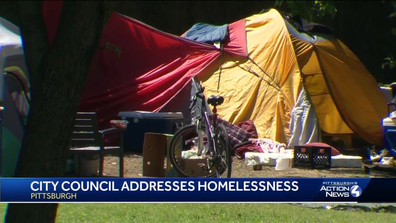
    I thought this was going to be a virtue signaling feel good story about the Seattle city government seizing hotel rooms to keep our vulnerable homeless population safe from the impending doom caused by the atmospheric river.
Sign In or Register to comment.